top of page


都市氣候與環境模擬
Urban Climate & Environmental Simulation
Project 1.
三維都市情境生成與微氣候模擬
Scenario and Microclimate Simulation
本研究聚焦於都市微氣候與開發規劃之整合,建構以三維都市模型為基礎的情境生成方法,結合程序式建模與統計抽樣,系統化產生多元開發情境,並納入都市設計準則與土地使用分區等規劃管制條件,以評估不同開發型態對都市微氣候之影響。
This study focuses on integrating urban microclimate considerations into development planning. A 3D urban modeling framework combining procedural modeling and statistical sampling is developed to systematically generate diverse development scenarios under planning constraints, such as urban design guidelines and land-use zoning controls, for evaluating their impacts on the urban microclimate.
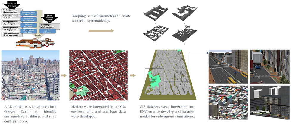
三維都市建置與模擬過程
3D Urban Modeling and Simulation Process
Project 2.
都市形態與風環境降溫模擬
Urban Form and Wind Cooling Simulation
著眼於大尺度且具開發彈性的都市地區,從都市形態角度探討不同空間型態所形成的風環境,及其對熱島效應的緩解作用。主要以 ENVI-met 進行情境模擬,並以都市形態指標組合作為情境參數,系統分析都市形態、風環境與熱島效應之關係,進一步提出空間規劃建議。
This study focuses on large-scale urban areas with greater development flexibility and examines how different urban forms shape wind environments and contribute to urban heat island mitigation. ENVI-met is used for scenario simulations, with combinations of urban morphology indicators serving as key parameters. The study systematically analyzes the relationships among urban form, wind environment, and heat island effects, and further proposes spatial planning recommendations.
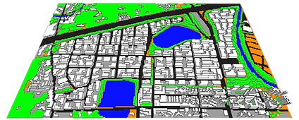
情境設定 Scenario settings
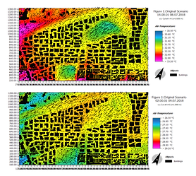
對溫度之影響
Impacts on temperature
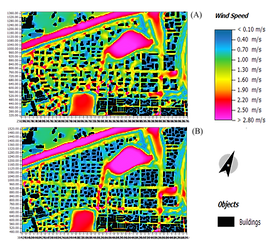
對風速之影響
Impacts on wind speed

建築高度變異與風速比較
Building Height Variation and Wind Speed Comparison
Project 3.
土地變遷與高溫分布
Land-Use Change and Heat Distribution
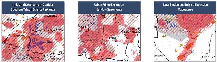
此研究以臺南市為實證地區,整合多層感知器(MLP)、馬可夫鏈細胞自動機(Cellular Automata–Markov Model)與 InVEST Urban Cooling Model,模擬未來土地利用變遷,並進一步評估其所造成之土地覆蓋、綠地與建成環境配置改變,如何影響都市降溫效益及近地表空氣溫度之空間分布。研究成果可用於辨識土地開發與熱環境變化之關聯及高風險區域,作為都市計畫通盤檢討、空間配置及調適措施優先布局之依據。
This study uses Tainan City as the empirical study area and integrates a Multi-Layer Perceptron (MLP), the Cellular Automata–Markov Model, and the InVEST Urban Cooling Model to simulate future land-use change. It further evaluates how changes in land cover, green space, and the built environment induced by land-use transitions affect urban cooling benefits and the spatial distribution of near-surface air temperature. The results can help identify the relationship between land development and thermal environmental change, as well as high-risk areas, providing a basis for comprehensive urban plan reviews, spatial allocation, and the prioritization of adaptation measures.

土地利用變遷模擬 Land-use simulation

地表氣溫計算與分析 Air-temperature estimation
bottom of page